Tag Archives: archaeology
3. South-east wall
4. An unusual building
Panel 1. The archaeological site of Puig Ciutat
Where is it?
The archaeological site of Puig Ciutat is located in the municipal district of Oristà (Barcelona province). The archaeological site is currently located at the top of an elevated plain 526 metres (1,700 ft) above sea level. It covers a surface area of 5.1 hectares (12.6 acres), distributed over farmland and steeply sloping areas.
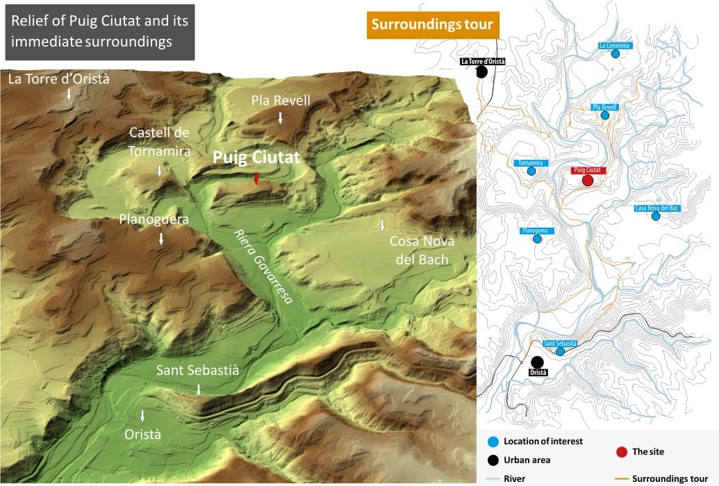
The hill is surrounded by two watercourses, the river Gavarresa and one of its affluents, the river Olost, which make the site very valuable from a defensive and strategic point of view.
What is its historical context?
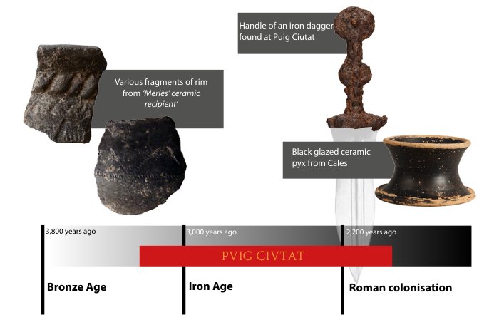
Research has revealed archaeological evidence of different chronological phases that go from the Late Bronze Age or Early Iron Age to the Late Roman Republican Period (mid-1st century BC).
Most of the information we have at the moment relates to the late Roman Republican period. At that time, Puig Ciutat could have played a role as a garrison or military camp (praesidium). At the end of this period Rome’s Civil War between Julius Caesar and followers of Gnaeus Pompeius took place (BC 49 – 44).
How can we visit?
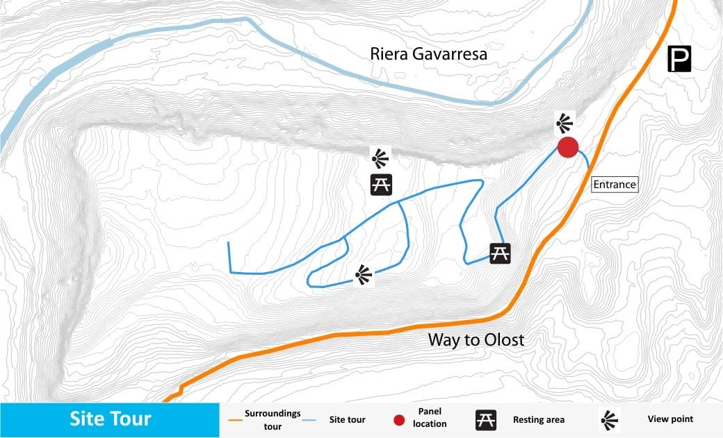
So far only a small part of the Puig Ciutat site has been excavated. The rest of the site is still buried. Two routes have been set up for visiting the consolidated remains:
1) A tour of the interior of the site: there are five information panels describing the settlement during the Late Republican Roman Period. The panels have QR codes to complement and enlarge on the information.
2) A tour of the site surroundings: provides a picture of the surrounding area and describes the geographical and natural conditions of Puig Ciutat.
Panel 2. Puig Ciutat: the city wall
Was Puig Ciutat a strategic control point?
The location of the settlement makes it very valuable from a defensive and strategic point of view as access is only by two natural routes to the north and south. However, the poor long-distance visibility might have made it necessary to have several control points in the vicinity.
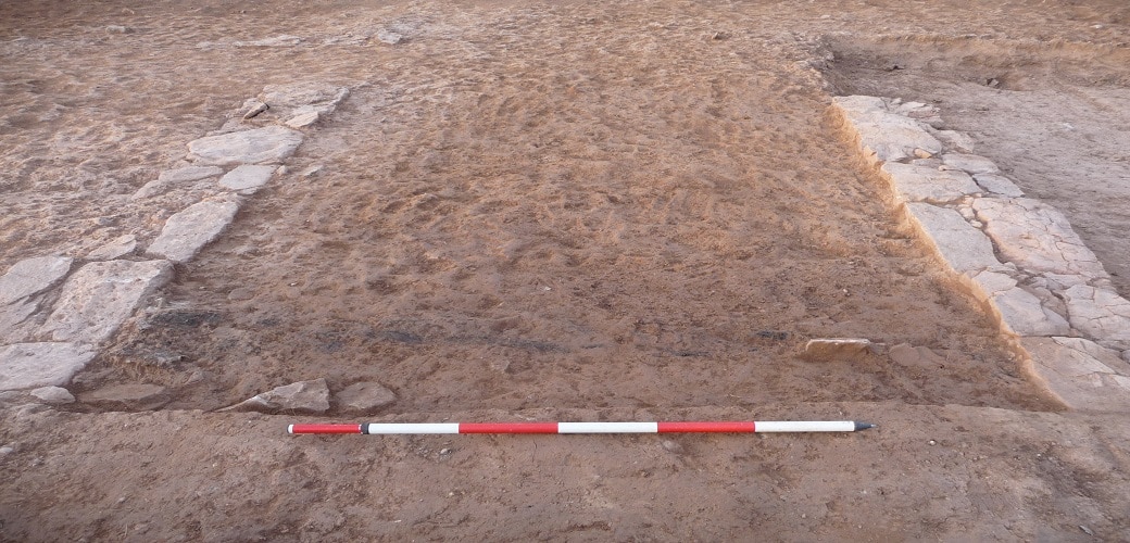
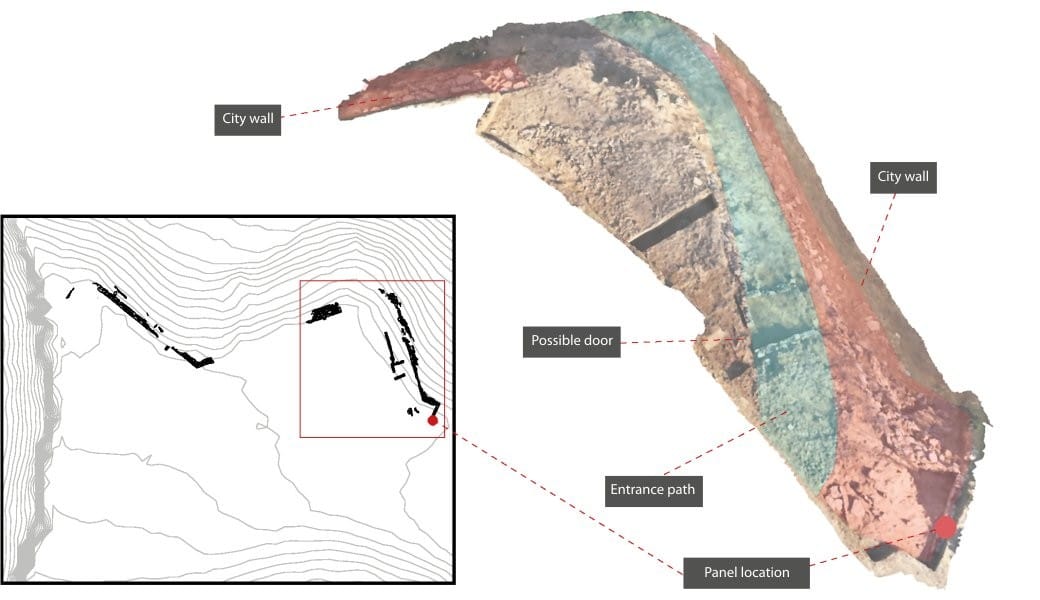
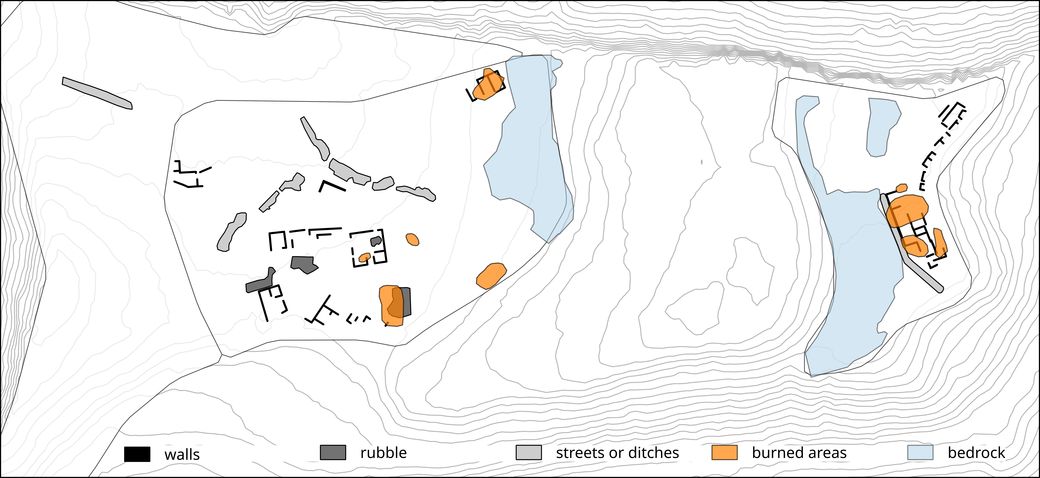
In two of the excavated areas a city wall from the Late Roman Republican Period was discovered.
The section of wall described in this panel is not currently visible. Until it has been consolidated, it has been covered over again to ensure its conservation.
Where was the way in?
The archaeological excavations suggest that the wall bordered the settlement on the east and south sides of the hill.
It’s difficult to know the exact location of the gates in the wall, on account of its eroded state. However, certain clues suggest the presence of a gate on the south-east flank of the site.
How did they get in?
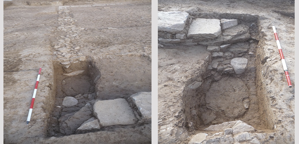
The excavation has revealed a rectangular construction located inside the wall.
Its purpose and date are unknown to us. It has a small, sealed entrance that could have been a second way into the settlement.
Who were they defending themselves from?
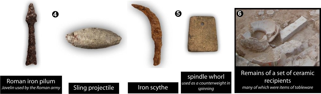
Roman military remains have been found in different parts of the site and its vicinity. This suggests a siege by Roman troops established in camps around the settlement.
It’s therefore believed that there could have been a confrontation between Romans.
Panel 4. Puig Ciutat: Life and siege
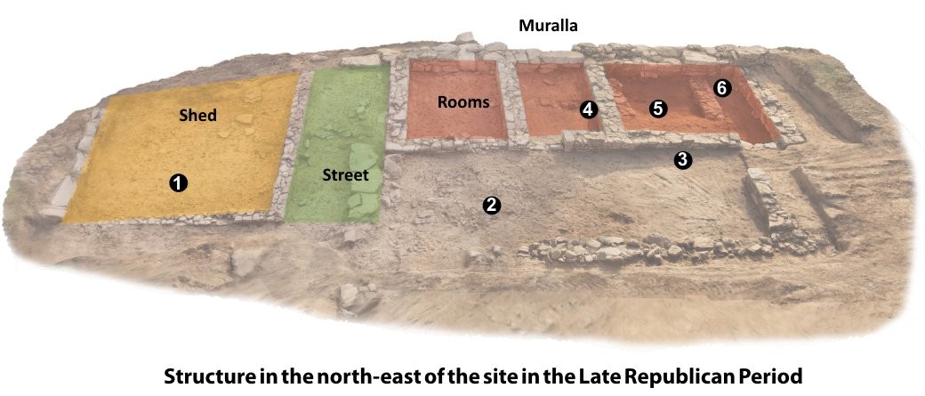
Archaeological excavations have revealed various compartments in one part of the north-east wall of the site.
Thanks to the quality and the state of preservation of the archaeological material identified in this area, we can date the last occupation phase at Puig Ciutat to the middle of the 1st century BC.
What did they eat?
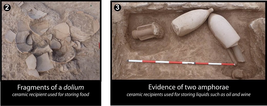
Among the archaeological remains, fragments were found of various ceramic recipients used for storage and transport of food products such as wheat, wine or oil.
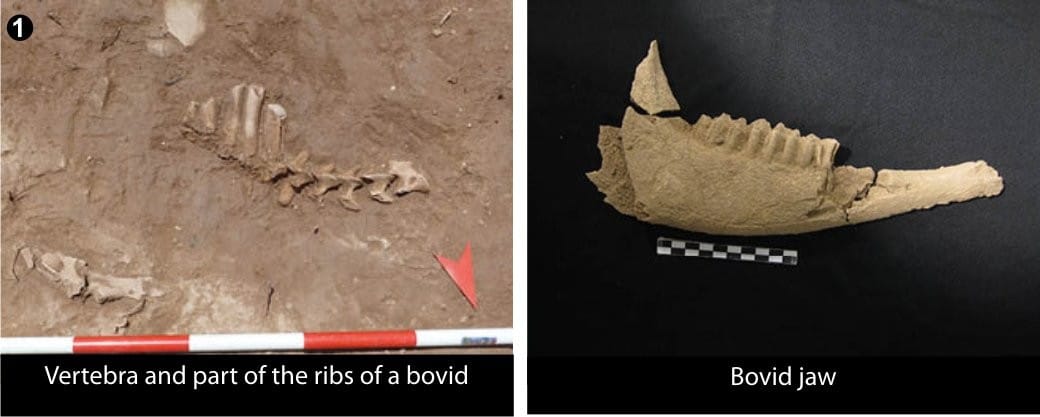
One room has a concentration of bones from large herbivores. It could well have been a place for storing meat or a stable.
What was life like there?
According to the research, the different rooms belonged to a complex building whose purpose is unknown to us. Some of the rooms could have combined different functions, as they were found to contain both material to do with the production of everyday elements and material relating to the storage, consumption and processing of food.
What happened to Puig Ciutat?
A large number of projectiles from an armed confrontation have been recovered. Burnt areas have also been located. This suggests that there was possibly violent destruction and the site was sacked. The distribution of these military elements in the various rooms in the area of the city wall speaks for an attack begun at this end of the settlement.
Panel 5. Puig Ciutat: A scientific and educational laboratory
Why is Puig Ciutat important?
The process of Romanisation in the Lluçanès region is still not fully understood. Nevertheless, the study of this archaeological site could spur new research into this historical period in Central Catalonia.
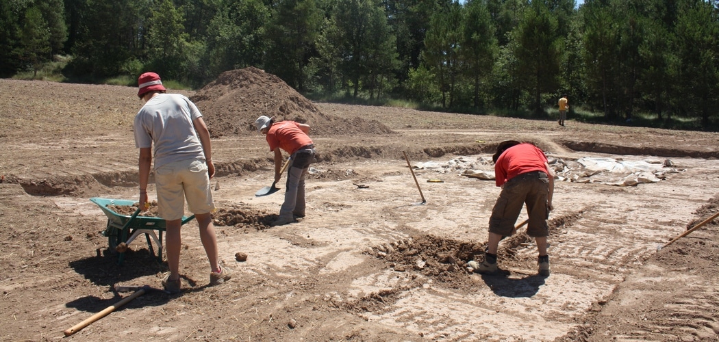
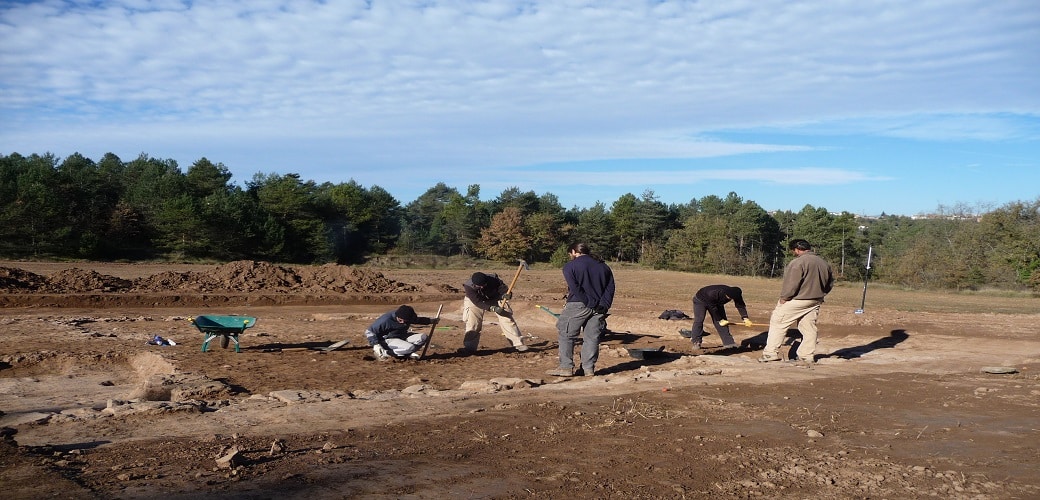
Since 2010, a team of researchers have performed various interventions on the Puig Ciutat site and its vicinity. These interventions were based on a multidisciplinary methodology which includes phases of surveying, excavation, treatment and publicising of the results.
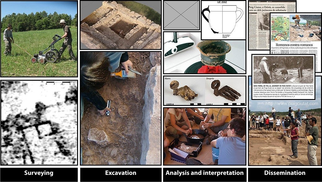
Surveying:
What does it consist of?
Reconnaissance and exploration of the archaeological area using satellite imagery, aerial photographs, topographical models, the search for surface remains (ceramics, metals, etc.) and geophysical methods.
What does it allow?
Detection, documentation and description of possible archaeological sites.
Planning of the excavation.
Excavation:
What does it consist of?
Excavating a particular terrain to locate clues and evidence of ancient societies.
What does it allow?
Recording and documentation of the remains discovered during fieldwork and the stratigraphic information obtained.
Interpretation:
What does it consist of?
Classifying, restoring, digitising and interpreting the archaeological material (ceramics, metals, fauna, etc.).
What does it allow?
Initiation of studies and formulation of hypotheses among specialists in Archaeological Science.
Dissemination:
What does it consist of?
Informing society about the research undertaken on the basis of the site, through reports, guided visits, congresses and media.
What does it allow?
Socialisation of scientific and cultural knowledge for all publics.
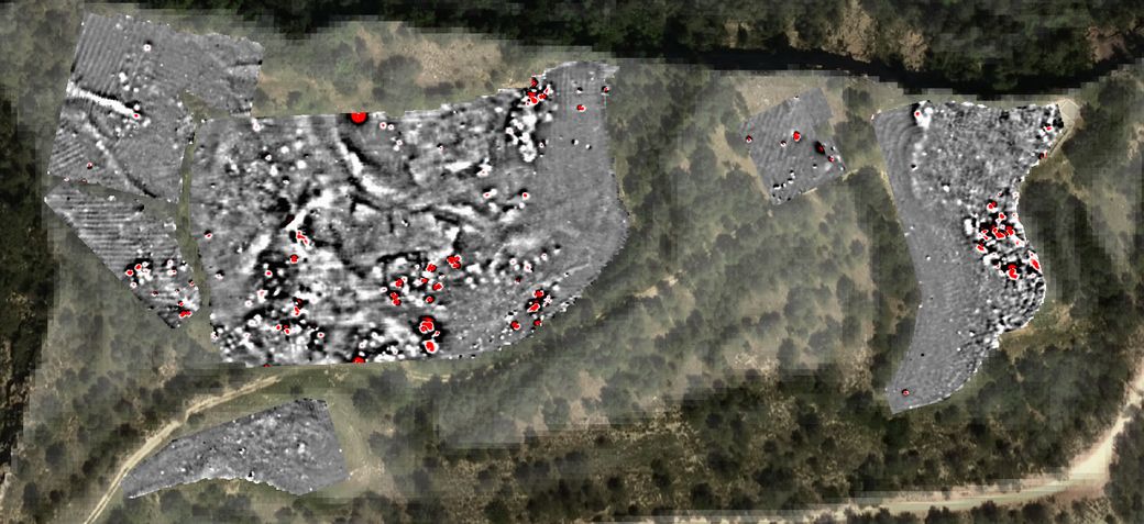
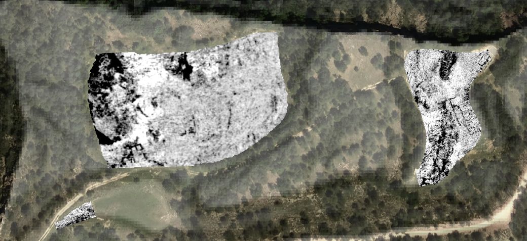
Panel 6. Puig Ciutat: Geophysical prospecting
What is geophysics and why is it applied in Puig Ciutat?
Geophysics is the science that applies non-invasive systems for exploring the subsoil. It was applied right from the start of the project as a tool that could help manage the excavations. Puig Ciutat is also an experimental site that enables us to test equipment and develop working methods. In addition to the surveys carried out in the early years, which are presented here, a systematic survey of each new area to be excavated is carried out at the beginning of each dig.
We are able to systematically apply geophysical techniques at Puig Ciutat thanks to the participation of the company SOT Prospecció Arqueològica.
Magnetic prospecting
What does it consist of? This measures local variations in the Earth’s magnetic field.
What does it enable us to do? It is useful for identifying kilns, hearths, burned areas, metals, filled trenches, as well as for delimiting sites.
Ground-penetrating radar (GPR) prospecting
What does it consist of? This measures variations in humidity by emitting an electromagnetic pulse, the echoes of which are subsequently received at the surface
What does it enable us to do? It is useful for detecting built structures, and allows us to visualise what structures are like at depth.
Electromagnetic prospecting
What does it consist of? This measures variations in conductivity and magnetic susceptibility by analysing the way the subsoil responds to an electromagnetic field applied from the surface.
What does it enable us to do? It is useful for characterising substrate composition and indirectly defining parameters like salinity, permeability, and porosity.
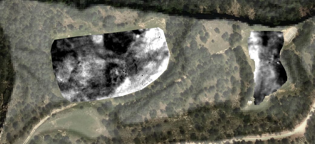
Interpretation of results
What does it consist of? This gives archaeological meaning to variations in the physical properties of the subsoil.
What does it enable us to do? This allows us to extract the archaeologically most significant elements from the geophysical images
Aerial and relief images: www.icgc.cat
Panel 7. Puig Ciutat: an unusual building
Archaeology, like any science, has its own methodology which is adapted according to the objectives and circumstances of each case being studied. In this respect, the work undertaken on the structures of the present building serve as an example to explain the scientific method applied in Puig Ciutat.
The present state of the excavations does not yet allow an answer to many of the questions hinging on the site. Nevertheless, geophysical surveying has made it possible to focus the excavation in those areas where the presence of built structures has been recorded. Thanks to this strategy, in a short time we have been able to obtain the largest possible quantity of data for drawing up the first interpretative hypotheses.
Surveying:
What do we know?
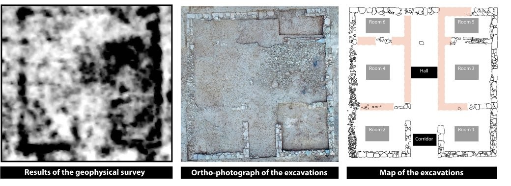
Geophysical surveying has identified the presence of a building in the middle of the agricultural area. Some of the techniques used, such as ground-penetrating radar, have made it possible to define the geometry of the structure and establish its depth about 0.5 metres (20 inches) beneath the surface.
Excavation:
What do we see?
A building measuring 11 x 11 metres with an entrance in the form of a passageway which very probably opened onto a distribution space inside. Two rooms have also been made out abutting the main façade and, finally, a space subdivided into four compartments at the back. The two innermost rooms are of a smaller size.
In the course of the excavation, a large amount of carbon and shattered ceramics have been documented that suggest the building may have been destroyed.
Interpretation:
What do we deduce?
The building is an unusual construction that stands out in the settlement. Its size suggests it could be the residence of the commander or person in charge of the establishment praetorium) or a building with an important administrative function in the same context (principium).
Although at present the data do not offer any more information about its purpose or its destruction, we hope to obtain more results in future work.
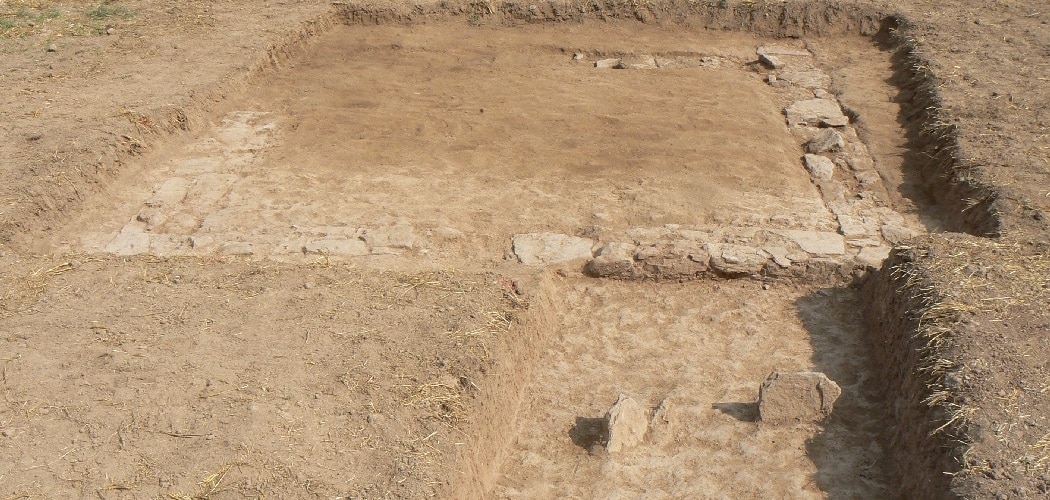
Building 1
Aquest sondeig es va realitzar amb l’objectiu de confirmar la presència i les característiques d’un edifici de grans dimensions, que havia estat prèviament detectat per les prospeccions geofísiques.
The archaeological excavation revealed a square building, 11 by 11 metres, divided up into various rooms opening onto a central distribution space. This was reached by a passage that communicated with the building’s only entrance, open in the southern façade. The date provided by the ceramic material recovered confirmed that the building belonged to the latest phase of occupation of the settlement, in the Late Roman Republican Period.
The work revealed that the structure had been heavily affected by farming work in the field in recent times and some of the walls that divided up the complex have not survived. Despite the poor condition of the remains, carbon was found which could have been part of the door latch.
Two surveys performed in the interior of the building showed that it had been looted in ancient times, probably to recover some of the stones from the north and west walls.
Its large size make this building an important one in the settlement’s complex of buildings. According to documentary sources, a building of these characteristics could have been the praetorium, or residence of the Roman camp’s Commander, or the principia, or administrative building. In the case of Puig Ciutat, this building could have fulfilled both functions.
![[left] Drawing of the structures located superimposed on the ground-penetrating radar data. [right] Interpretation of the located structures superimposed on a photograph taken from a drone.](https://www.puigciutat.com/wp-content/uploads/2016/01/Sectors-edifici-11.jpg)