What is geophysics and why is it applied in Puig Ciutat?
Geophysics is the science that applies non-invasive systems for exploring the subsoil. It was applied right from the start of the project as a tool that could help manage the excavations. Puig Ciutat is also an experimental site that enables us to test equipment and develop working methods. In addition to the surveys carried out in the early years, which are presented here, a systematic survey of each new area to be excavated is carried out at the beginning of each dig.
We are able to systematically apply geophysical techniques at Puig Ciutat thanks to the participation of the company SOT Prospecció Arqueològica.
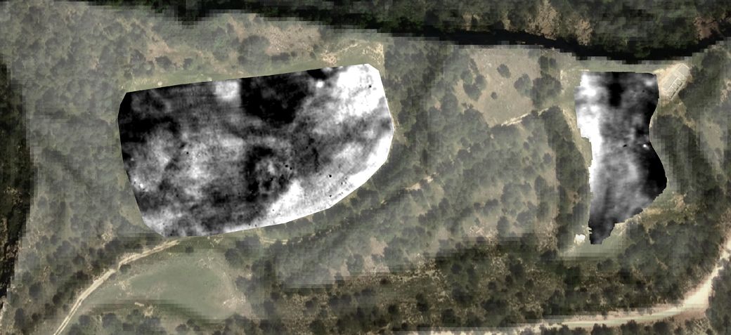
Magnetic prospecting
What does it consist of? This measures local variations in the Earth’s magnetic field.
What does it enable us to do? It is useful for identifying kilns, hearths, burned areas, metals, filled trenches, as well as for delimiting sites.
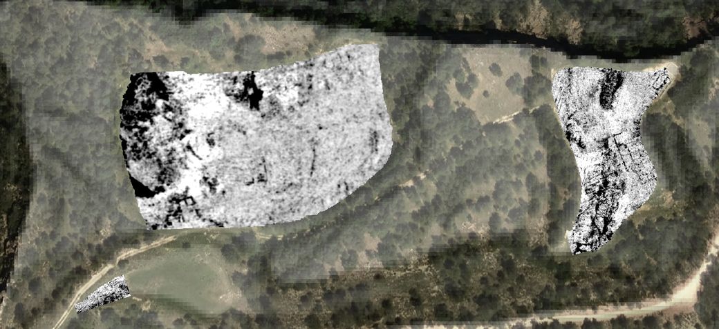
Ground-penetrating radar (GPR) prospecting
What does it consist of? This measures variations in humidity by emitting an electromagnetic pulse, the echoes of which are subsequently received at the surface
What does it enable us to do? It is useful for detecting built structures, and allows us to visualise what structures are like at depth.
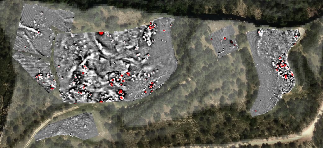
Electromagnetic prospecting
What does it consist of? This measures variations in conductivity and magnetic susceptibility by analysing the way the subsoil responds to an electromagnetic field applied from the surface.
What does it enable us to do? It is useful for characterising substrate composition and indirectly defining parameters like salinity, permeability, and porosity.
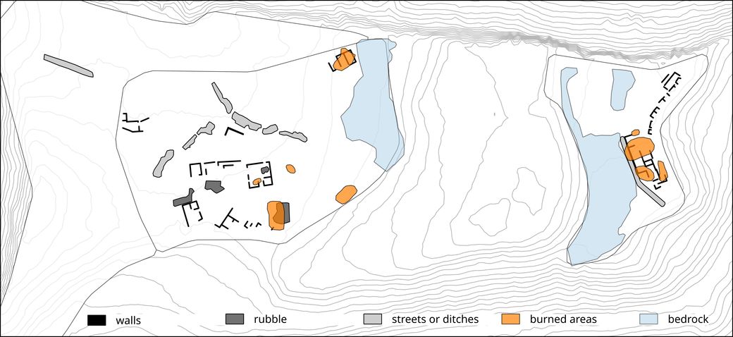
Interpretation of results
What does it consist of? This gives archaeological meaning to variations in the physical properties of the subsoil.
What does it enable us to do? This allows us to extract the archaeologically most significant elements from the geophysical images
Aerial and relief images: www.icgc.cat