New Technologies
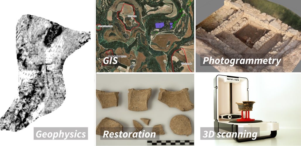
Ever since the first season during the spring and summer of 2010, Puig Ciutat has become an experimental site using innovative archaeological methods thanks to the introduction and application every year of new technologies and research techniques. Among the different techniques used, the main ones are geophysical surveying, development of several GIS applications and the use of 3D techniques that help us understand the settlement in its surroundings, as well as the different archaeological structures discovered.
Geophysics
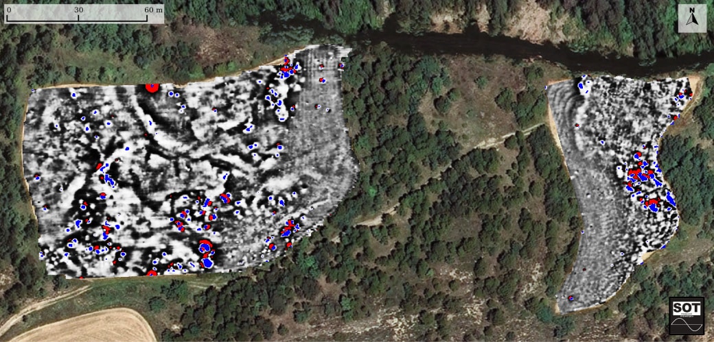
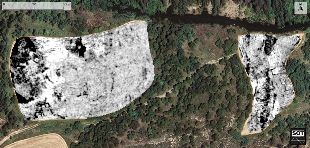
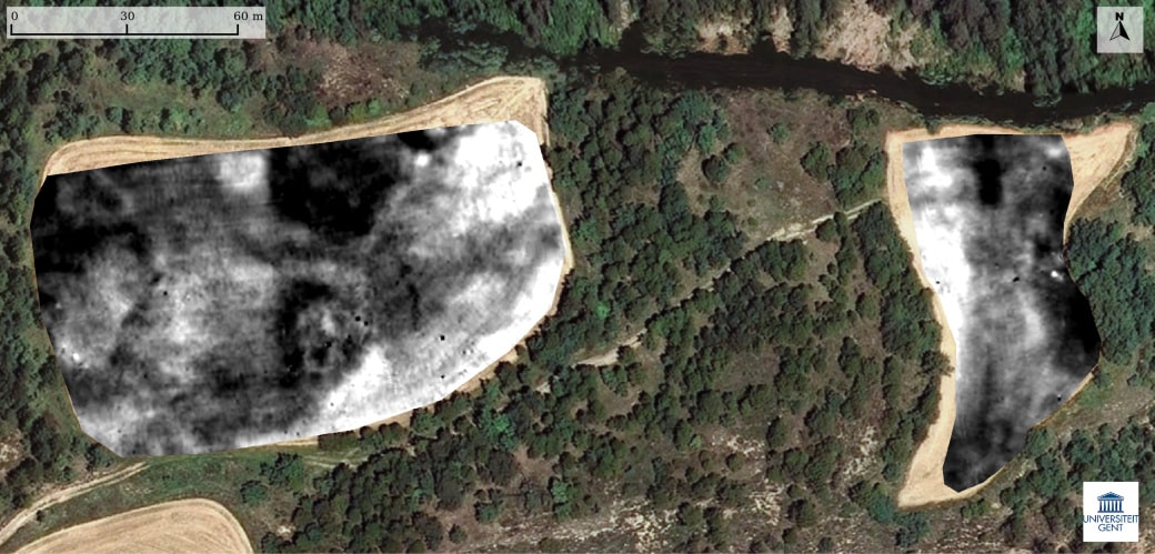
Geophysical methods have made it possible to explore the site in detail and more exactly define the geometry of the structures and their geological surroundings. In this context, geophysical surveying has centred on two fields in the western section and, especially, on the field in the eastern sector, as they allow extensive work that is impossible in the wooded areas.
The main techniques used are magnetic surveying, which provides information on areas with alterations in the electromagnetic field like the ones produced by combustion, ground-penetrating radar, which provides a more precise description of built structures, and electrical surveying, which documents variations in the potentials of sediments.
The results and interpretations obtained with the different techniques are used in the planning and management of subsequent excavations.
Image: © Orthophotograph property of the Institut Cartogràfic i Geològic de Catalunya, accessible on www.icgc.cat.
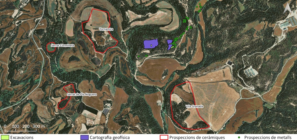
Geographic Information Systems
In view of the multidisciplinary nature of the Puig Ciutat archaeological project, it was necessary to develop a common platform from which to visualise and interpret the data obtained. In this respect, the platform used was built using the Qgis free software program. Alongside this, the Sig.Arq. program was used to manage the results of the excavations. This program allows you to enter the results of excavations in a spatial data base in a way that is systematic, uniform and georeferenced.
Image: Orthophotograph property of the Institut Cartogràfic i Geològic de Catalunya, accessible on www.icgc.cat.
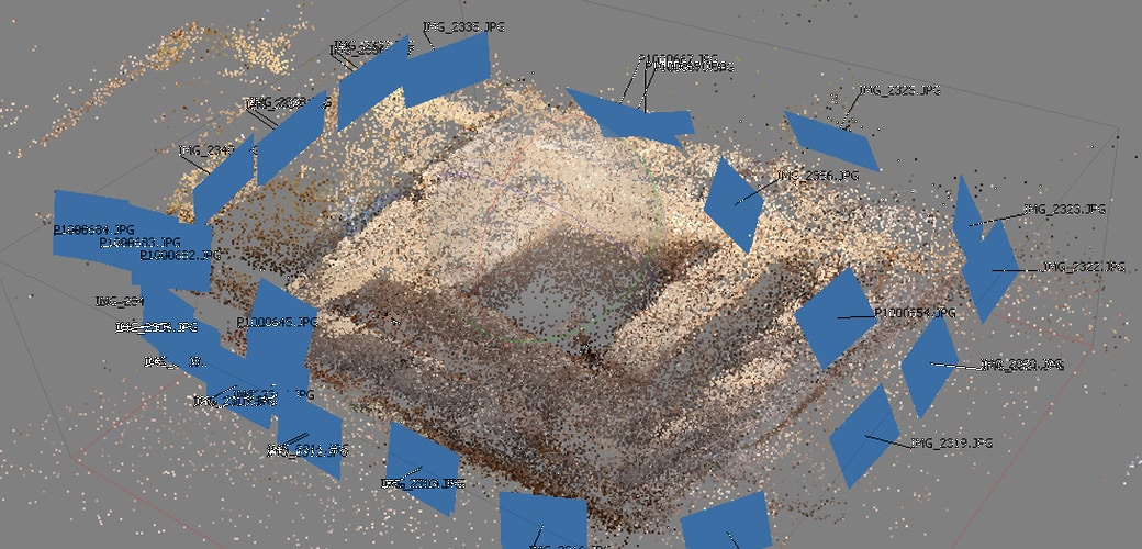
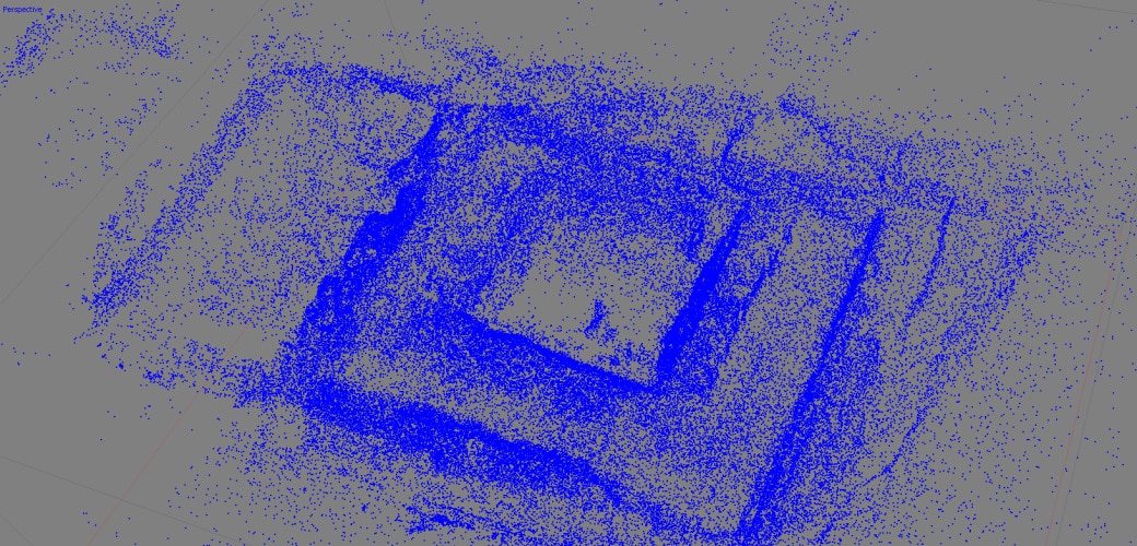
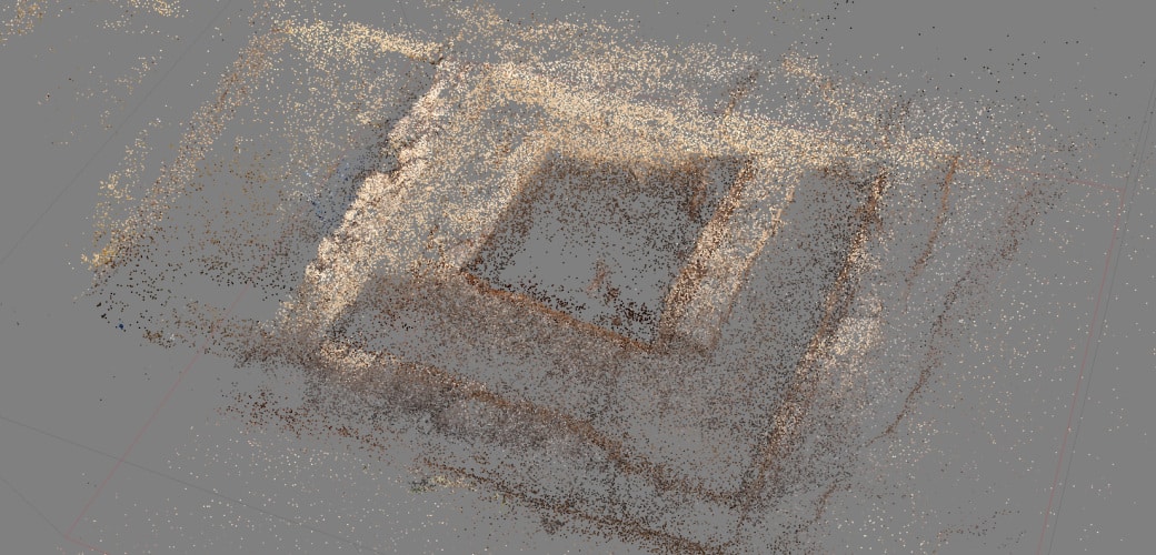
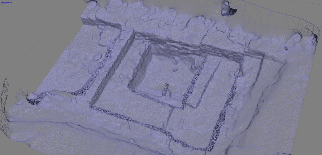
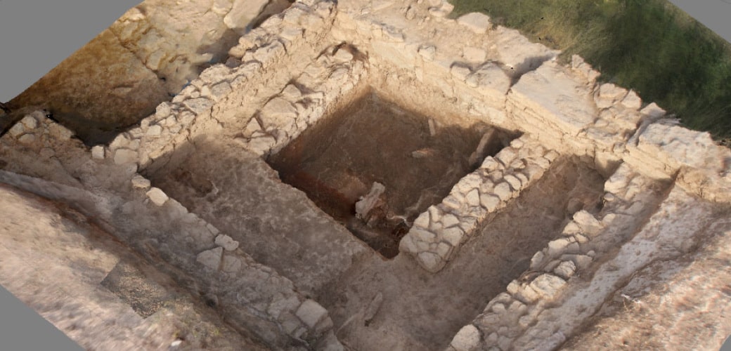
Photogrammetry
To analyse and document the best-preserved structures in the Puig Ciutat site in detail, several photogrammetric studies have been performed. This technique provides geometric, radiometric and semantic information about three-dimensional objects in reality, using different photographs taken from different points of view. The model generated, despite not having real measurements, does have relative measurements that can be converted to real measurements and even to geolocation points if backup markers on the ground are used. This technique produces a model of reality, first in the form of points and polygons and, subsequently, on a solid, textured surface. In this respect, photogrammetry not only provides volumes and 3D measurements, it also offers quality, accuracy and speed in the execution and obtention of large amounts of information.
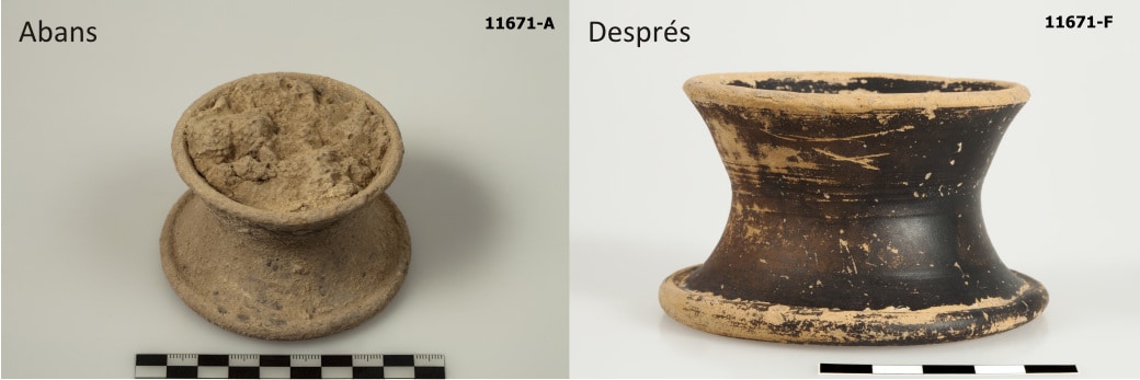
Restoration
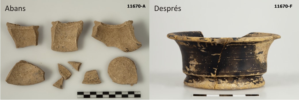
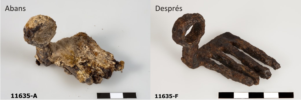
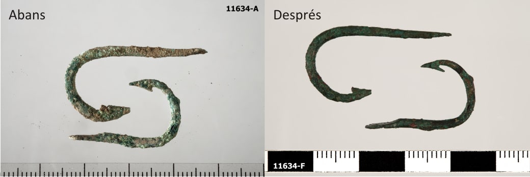
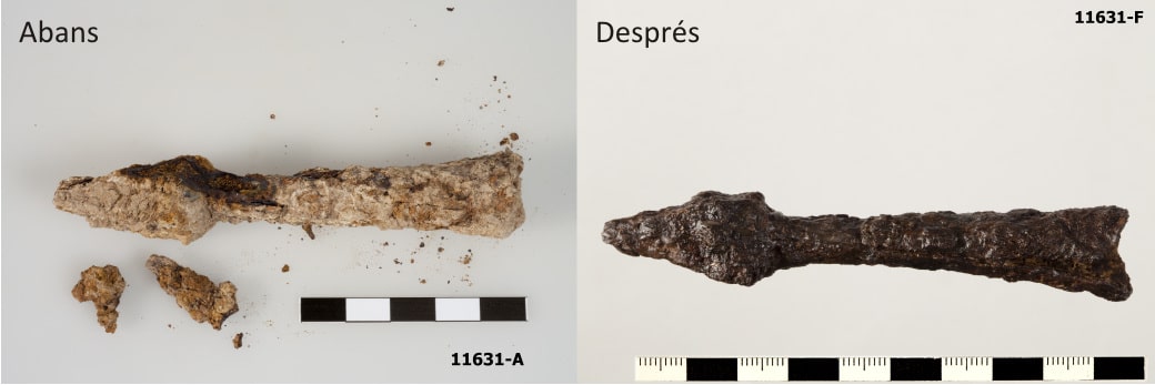
The process of restoring archaeological movable objects begins the moment they are discovered, as the state in which they are found in the subsoil is altered. The aim of acting on archaeological material is to recover the objects’ lost solidity and stabilise all active factors of alteration.
To a large extent, restoring Puig Ciutat has been the work of Eulàlia Ribó and thanks to the availability of the Centre de Restauració de Béns Mobles de Catalunya (CRBMC, Catalan Restoration Centre for Movable Heritage).
Photographs by Ramon Maroto (CRBMC).
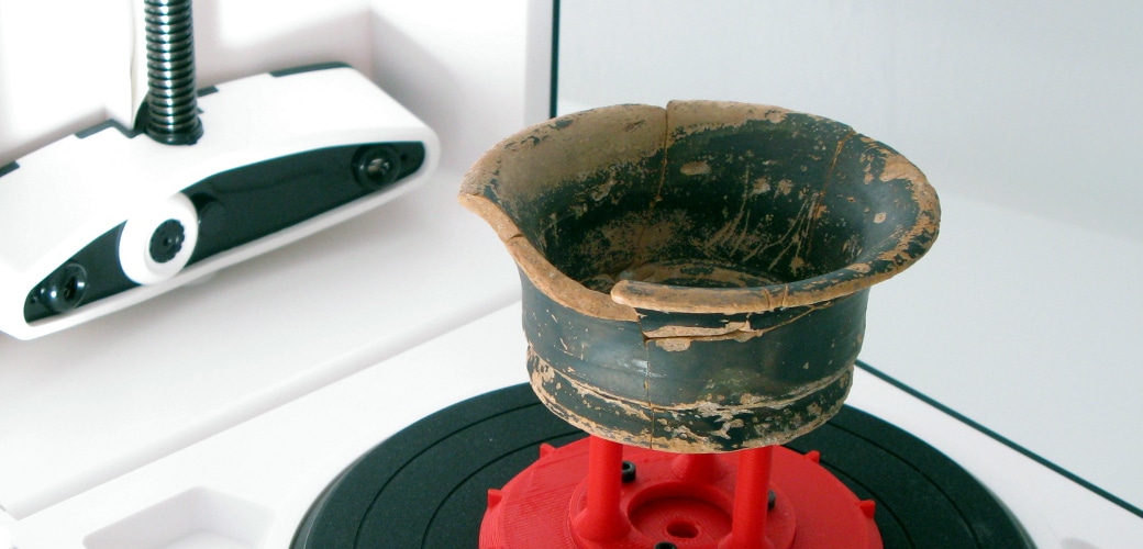
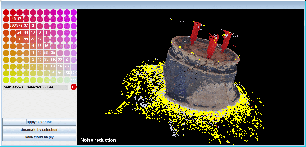
3D scanning
So as to document the most important and best-preserved items in 3D, a low-cost scanning system has been used which is known as the Matter and Form project. With this we can generate a 3-dimensional digital version of the main items in a short time. The main object of this operation is to aid in reporting and disseminating the different materials recovered during the different archaeological campaigns through a Virtual Museum.