Why is Puig Ciutat important?
The process of Romanisation in the Lluçanès region is still not fully understood. Nevertheless, the study of this archaeological site could spur new research into this historical period in Central Catalonia.
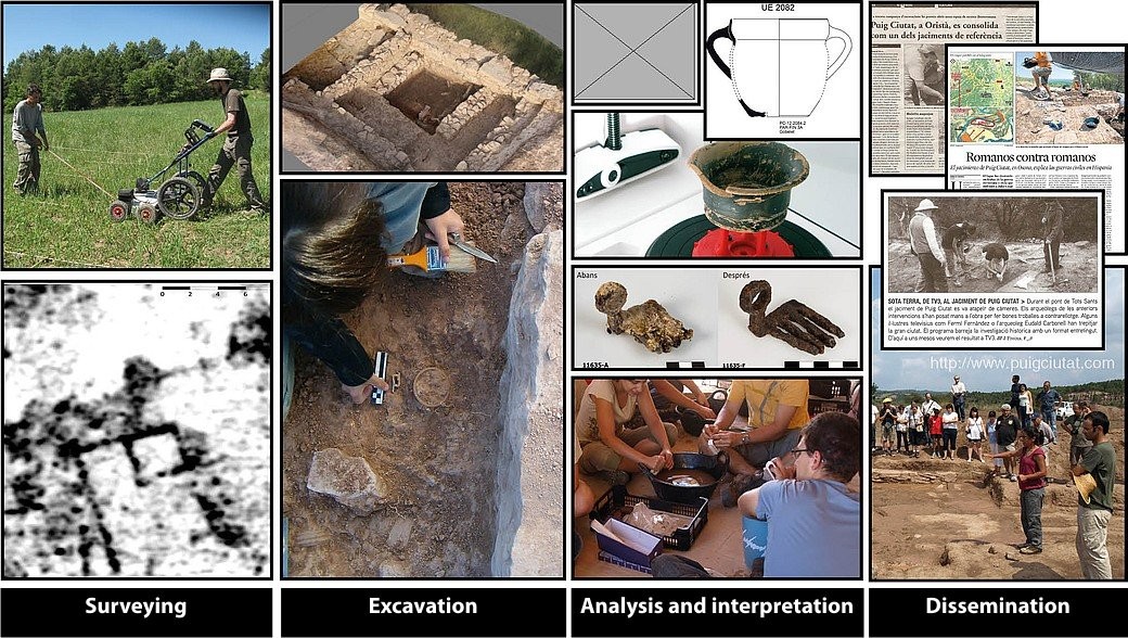
Since 2010, a team of researchers have performed various interventions on the Puig Ciutat site and its vicinity. These interventions were based on a multidisciplinary methodology which includes phases of surveying, excavation, treatment and publicising of the results.
Surveying:
What does it consist of?
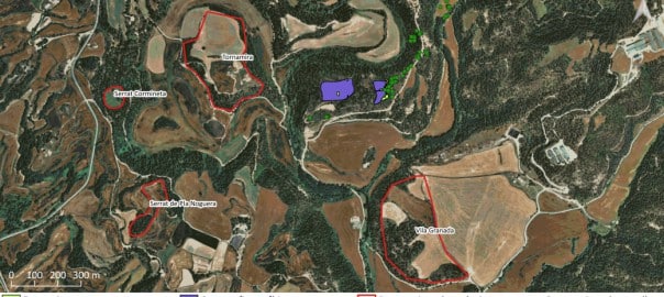
Reconnaissance and exploration of the archaeological area using satellite imagery, aerial photographs, topographical models, the search for surface remains (ceramics, metals, etc.) and geophysical methods.
What does it allow?
Detection, documentation and description of possible archaeological sites.
Planning of the excavation.
Excavation:
What does it consist of?
Excavating a particular terrain to locate clues and evidence of ancient societies.
What does it allow?
Recording and documentation of the remains discovered during fieldwork and the stratigraphic information obtained.
Interpretation:
What does it consist of?
Classifying, restoring, digitising and interpreting the archaeological material (ceramics, metals, fauna, etc.).
What does it allow?
Initiation of studies and formulation of hypotheses among specialists in Archaeological Science.
Dissemination:
What does it consist of?
Informing society about the research undertaken on the basis of the site, through reports, guided visits, congresses and media.
What does it allow?
Socialisation of scientific and cultural knowledge for all publics.