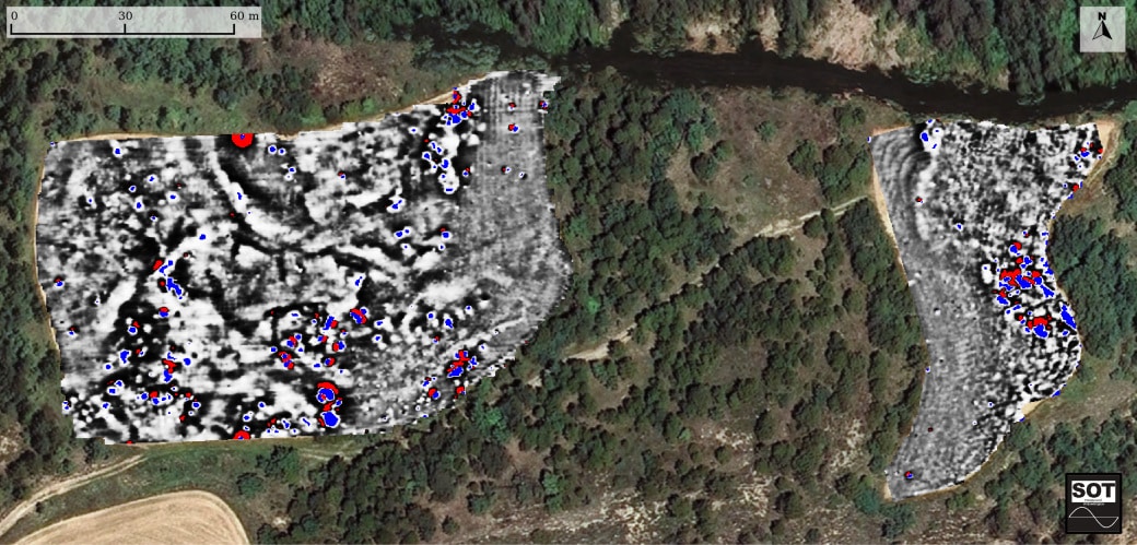
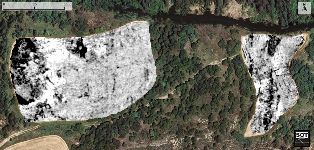
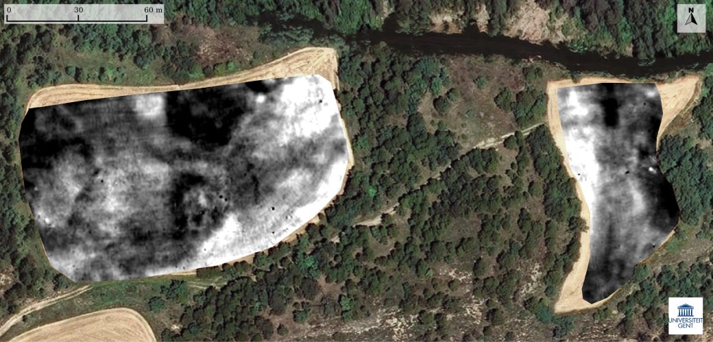
Geophysical methods have made it possible to explore the site in detail and more exactly define the geometry of the structures and their geological surroundings. In this context, geophysical surveying has centred on two fields in the western section and, especially, on the field in the eastern sector, as they allow extensive work that is impossible in the wooded areas.
The main techniques used are magnetic surveying, which provides information on areas with alterations in the electromagnetic field like the ones produced by combustion, ground-penetrating radar, which provides a more precise description of built structures, and electrical surveying, which documents variations in the potentials of sediments.
The results and interpretations obtained with the different techniques are used in the planning and management of subsequent excavations.
Image: © Orthophotograph property of the Institut Cartogràfic i Geològic de Catalunya, accessible on www.icgc.cat.