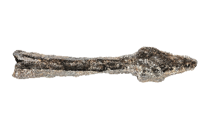
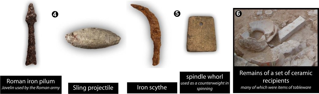
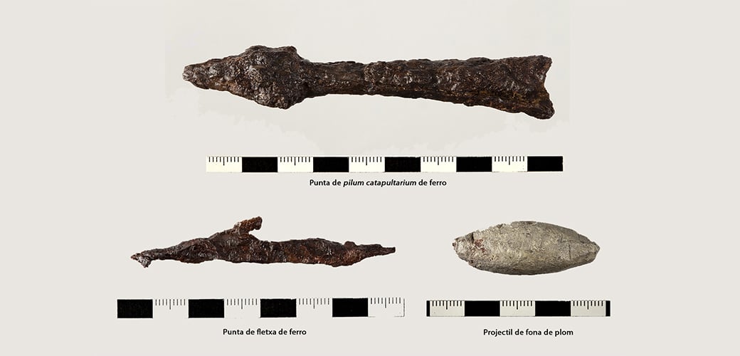
Inventory number: PC10-2005-508 Name of the object: head of a pilum catapultarium Material: metal, iron Type: weaponry Dimensions: total length: 10,3cm; length of the body:7,1cm; length of the head: 3,2 cm. irregular diametre of the body: from 1,8 cm at the openeing, to 1,1 cm where the head starts. Maximum width at the base of the head: 1,6 cm. Weight: 60gr. Chronology: Roman Late Republic Survey: july 2010 Provenance: sector 2 Description: Square-sectioned compact, solid pilum catapultarium bolt with socket attachment to the shaft. Catapult bolts could be a very effective weapon for eliminating the defenders of a wall in a hypothetical siege.
The location of the settlement makes it very valuable from a defensive and strategic point of view as access is only by two natural routes to the north and south. However, the poor long-distance visibility might have made it necessary to have several control points in the vicinity.
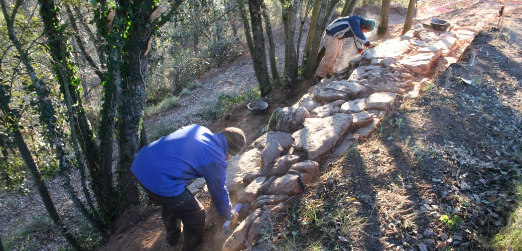
In two of the excavated areas a city wall from the Late Roman Republican Period was discovered.
The section of wall described in this panel is not currently visible. Until it has been consolidated, it has been covered over again to ensure its conservation.
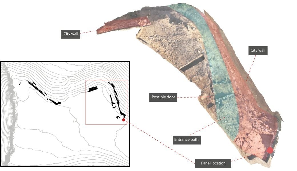
Where was the way in?
The archaeological excavations suggest that the wall bordered the settlement on the east and south sides of the hill.
It’s difficult to know the exact location of the gates in the wall, on account of its eroded state. However, certain clues suggest the presence of a gate on the south-east flank of the site.
How did they get in?
The excavation has revealed a rectangular construction located inside the wall.
Its purpose and date are unknown to us. It has a small, sealed entrance that could have been a second way into the settlement.
Who were they defending themselves from?
Roman military remains have been found in different parts of the site and its vicinity. This suggests a siege by Roman troops established in camps around the settlement.
It’s therefore believed that there could have been a confrontation between Romans.
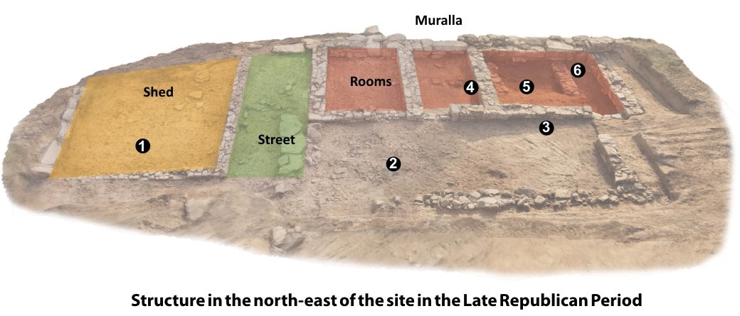
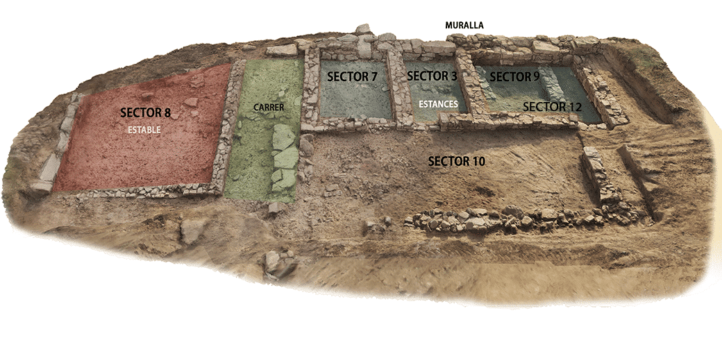
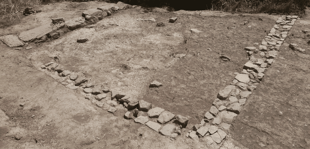
Archaeological excavations have revealed various compartments in one part of the north-east wall of the site.
Thanks to the quality and the state of preservation of the archaeological material identified in this area, we can date the last occupation phase at Puig Ciutat to the middle of the 1st century BC.
What did they eat?
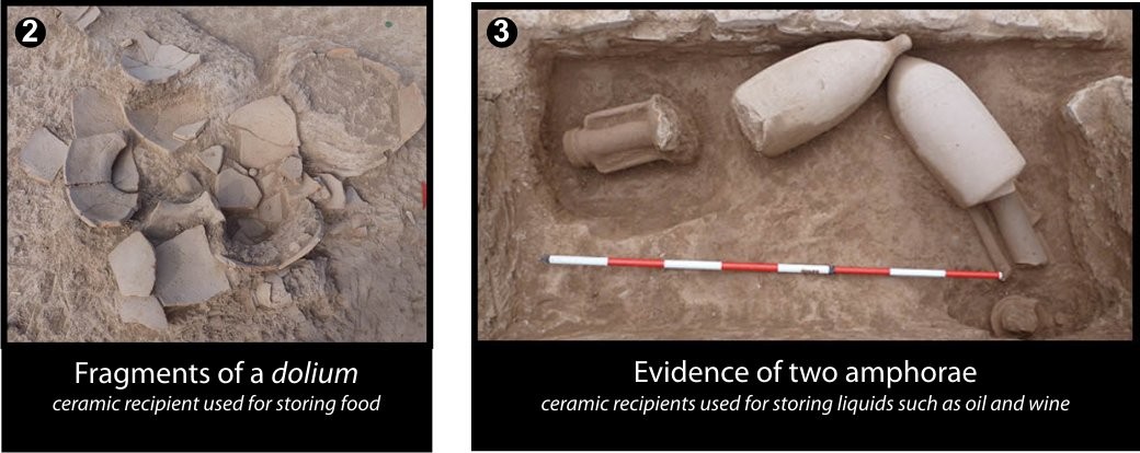
Among the archaeological remains, fragments were found of various ceramic recipients used for storage and transport of food products such as wheat, wine or oil.
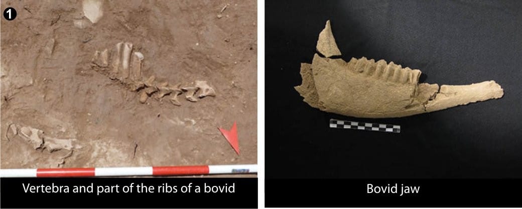
One room has a concentration of bones from large herbivores. It could well have been a place for storing meat or a stable.
What was life like there?
According to the research, the different rooms belonged to a complex building whose purpose is unknown to us. Some of the rooms could have combined different functions, as they were found to contain both material to do with the production of everyday elements and material relating to the storage, consumption and processing of food.
What happened to Puig Ciutat?
A large number of projectiles from an armed confrontation have been recovered. Burnt areas have also been located. This suggests that there was possibly violent destruction and the site was sacked. The distribution of these military elements in the various rooms in the area of the city wall speaks for an attack begun at this end of the settlement.
Magnetic surveying showed evidence of an urban layout in the north-east of the site and important signs of combustion, which could have been from fireplaces or they could have been traces of a possible fire.
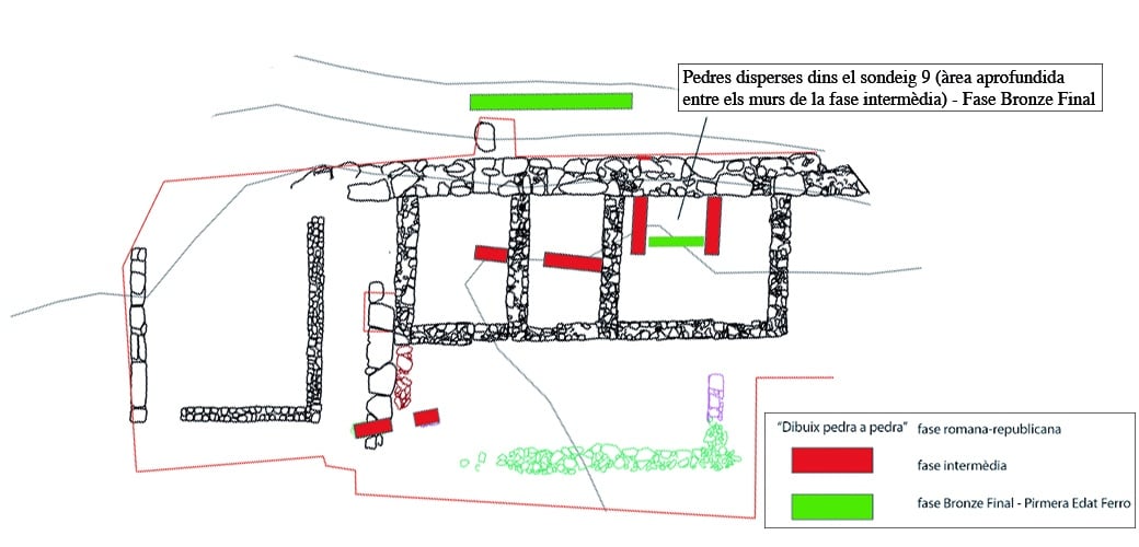
The excavations confirmed the presence of archaeological materials and structures from the settlement’s three occupation phases, going from the Late Bronze/Early Iron Age (mid-9th – 7th centuries BC) to the Late Roman Republican Period (mid-1st century BC).
Five dwelling spaces and a street from the last phase were found built onto the north-eastern section of the wall. These constructs could be part of one large building combining the functions of dwelling and storage.
The state of destruction of the different rooms, with abundant crushed ceramic material above the living level, and the presence of abundant military projectiles above the ruins (indicating they were fired from outside) speak for a military confrontation which may have begun at this end of the settlement.
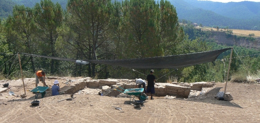
Excavation work in the buildings close to the Late Republican Roman wall
July 2012
Surveys of the different occupation phases at Puig Ciutat (Late Bronze/Early Iron (9th – 7th centuries BC) up to the Late Roman Republican Period (mid-1st century BC)
July 2015
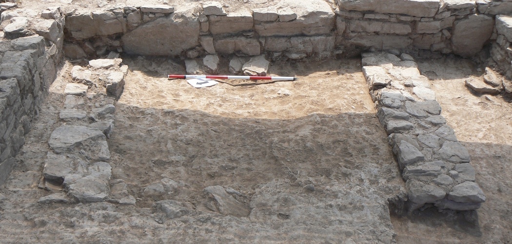
The inner face of the wall is built over the two walls from the previous occupation phase (intermediate phase) and above the demolition level of this same phase
July 2011
Photogrammetric study of the different constructions excavated at the north-eastern end of the settlement
December 2015.
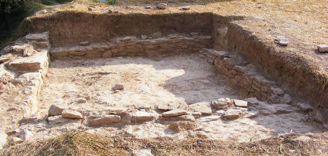
Constructions abutting the wall
July 2010
The process of excavating the hearth (redder area). At the bottom of the picture can be seen the test trench thanks to which the wall from the intermediate phase was discovered
July 2011
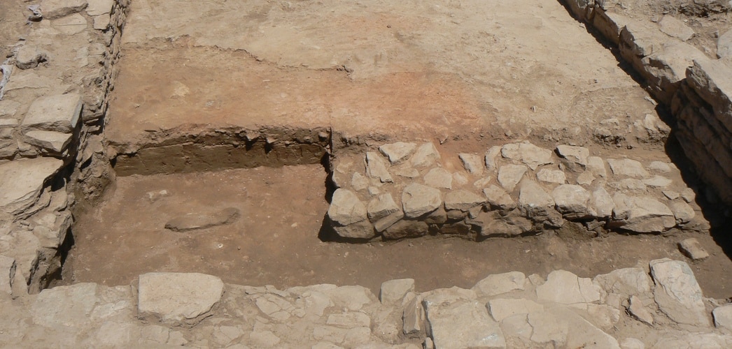
Excavation of the floor of the hearth, made with heat-resistant ceramics
July 2012
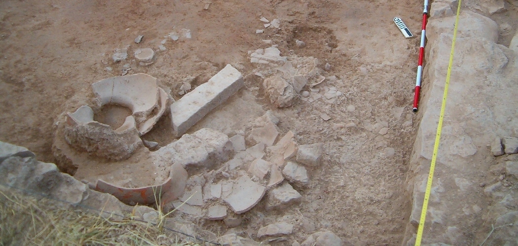
Scattered fallen material above the living level
July 2010
[left] Various fallen materials (remains of animals, metal objects, etc.) above the living level. [right] Fallen dolium and amphora above the ruins of a ceiling or a first floor
July 2011-2012
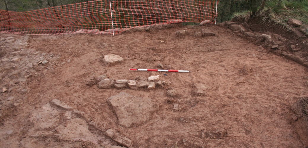
Northern room abutting the wall
July 2013
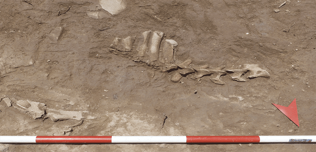
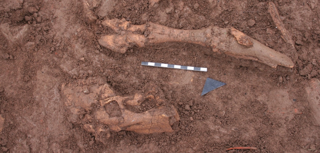
Articulated animal remains located under the ruins of the northern room
July 2013
Projectiles located in the rooms abutting the wall
Photographs by CRBMB-Ramon Maroto. July 2011-2012.
The intervention at this point reveals the presence of one of the main entrances to the settlement in its last phase. The suspicion that it was here was based on the fact that a path to the top of the hill from the east converges here with the main street in the area, which runs north-south.
The work located two sections of wall at this point, separated by a certain difference in height between them, at the ends of which there could have been the gate. It wasn’t possible to confirm this as they have been largely flattened. Even so, this idea is backed up by the presence inside the settlement of a wall parallel to the city wall that forms an entrance passage leading to a second gate, which was found to be sealed.
The structures preserved inside the settlement are totally unknown as the area was found covered by a thick layer of stones whose purpose could not be explained. The dating of the various associated articulated animal remains gave a date for it during the last occupation phase.
As a hypothesis, it was suggested that the layer of stones could have something to do with reinforcing the area or sealing it off in the settlement’s final moments, but we shall have to wait for future campaigns to be able to corroborate this.
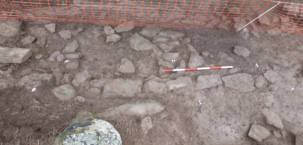
Fill level from the Late Roman Republican Period
Decembre 2014.
Western part of the trench
Structures dated from the Late Roman Republican Period can be observed. Decembre 2014.
Part of the cranium and a bovid articulated limb
Decembre 2014.
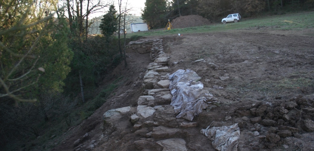
Sloping section of wall
Part of the wall and its ruins can be seen towards the slope. The wall running parallel to the city wall can be seen on the left, forming an entrance passageway. Decembre 2014.
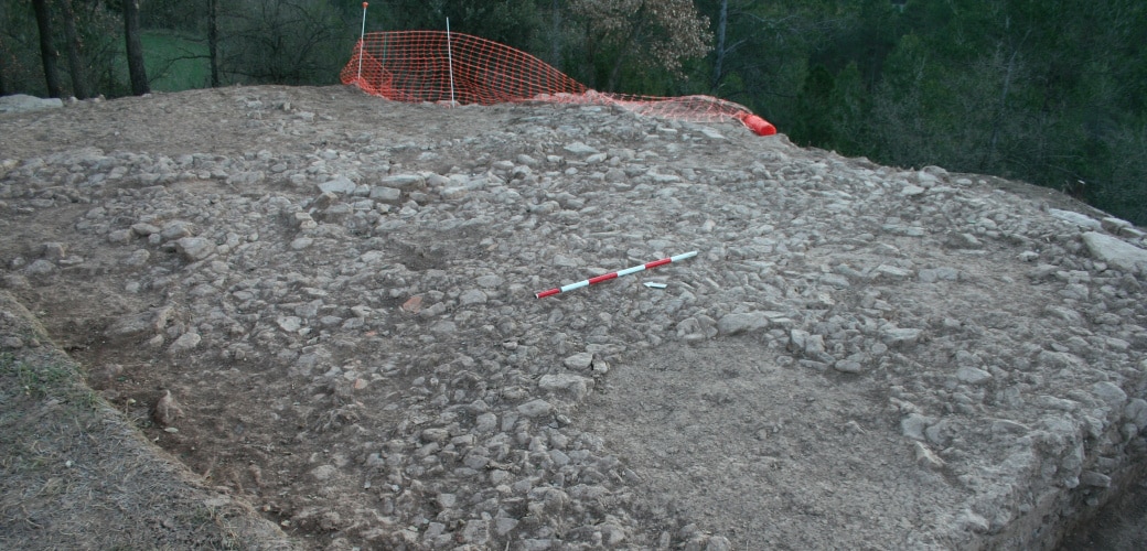
Section of city wall (north-east stretch)
Decembre 2014
[left]. Photogrammetric study at the end of the 2014 season. [right] Location of various excavated structures
At bottom left and top right, stretch of Late Republican city wall
Work on this point was carried out with the object of finding out all about the entire stretch of city wall already located and, at the same time, to see how the structure was laid down.
The work showed that the city wall was laid down directly over earlier strata. On this side it could be seen that the walls of the intermediate phase were visible under the Roman wall. A wall was also located belonging to the settlement’s oldest phase (Late Bronze/Early Iron). This is the earliest structure located for this period.
View of the Late Bronze/Early Iron Age structures outside the Late Republican city wall
Decembre 2014.
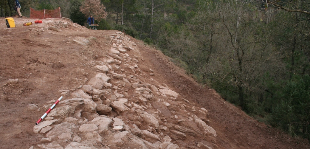
View of the Late Republican city wall from the north-east
Decembre 2014
[left]. Photogrammetric study and [right] drawing of the excavations at the end of the 2014 season
he outline of the Late Roman Republican city wall and the excavated structures can be clearly seen. Late Republican city wall and earlier structures located outside the area occupied by the Roman Republican settlement. Decembre 2014.
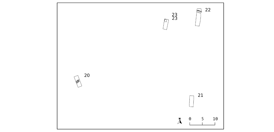
Surveys 20 to 23 had a common goal, which was to locate the city wall on the south side of the settlement.
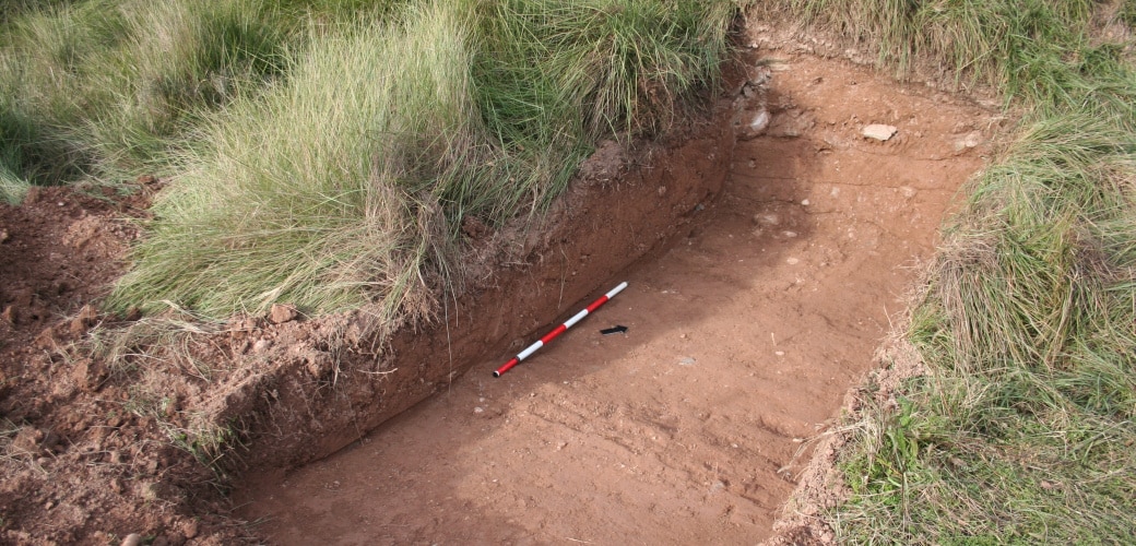
Survey 20: both the geophysical survey undertaken in 2010 and the electrical tomography at the end of 2014 indicated the presence of a stretch of city wall at this point. The work made it possible to locate the defensive structure of which only one level of stones has survived.
Survey 21: no remains of archaeological interest were found at this point. The stratigraphy seemed to respond to farm work in the area.
Survey 22: surface observation of two walls at this point, plus the marked difference in height, suggested that the city wall might be found here. The work showed that they were terraced vineyards from a more recent date.
Survey 23: surface observation of a wall at this point, plus the marked difference in height, suggested that the city wall might be found here. The work showed that they were terraced vineyards.
[left] Survey 20. Section of Late Roman Republican city wall. Survey 23: View of the test trench at the end of the excavation
Decembre 2014.
Survey 23: View of the test trench at the end of the excavation
Desembre 2014.
Survey 21: View of the test trench at the end of the excavation
Decembre 2014.
Location of the different surfaces intervened
The stretch of city wall located in survey 20 can be seen. Decembre 2014.
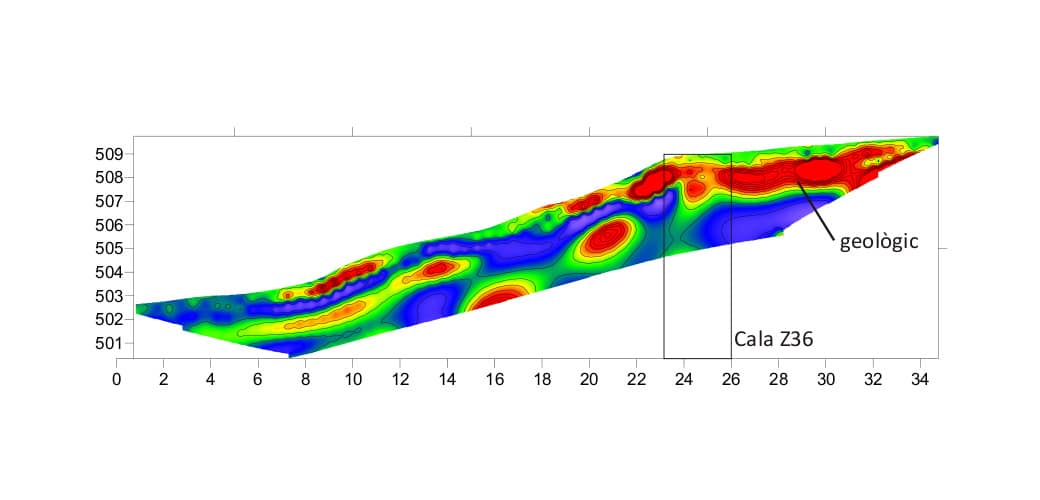
Electrical tomography (data acquisition by GS Ingeniería)
In red: rocky elements that could be bedrock or anthropic built elements. Decembre 2014.
![[left] Various fallen materials (remains of animals, metal objects, etc.) above the living level. [right] Fallen dolium and amphora above the ruins of a ceiling or a first floor](https://www.puigciutat.com/wp-content/uploads/2015/12/foto_7-i-11-copia.jpg)
![[left]. Photogrammetric study at the end of the 2014 season. [right] Location of various excavated structures](https://www.puigciutat.com/wp-content/uploads/2016/02/FOTOGRAMETRIA.png)
![[left]. Photogrammetric study and [right] drawing of the excavations at the end of the 2014 season](https://www.puigciutat.com/wp-content/uploads/2015/02/supi_19_fotogr.jpg)
![[left] Survey 20. Section of Late Roman Republican city wall. Survey 23: View of the test trench at the end of the excavation](https://www.puigciutat.com/wp-content/uploads/2015/02/26_39_sm.png)