Tag Archives: archaeology

City Wall Buildings

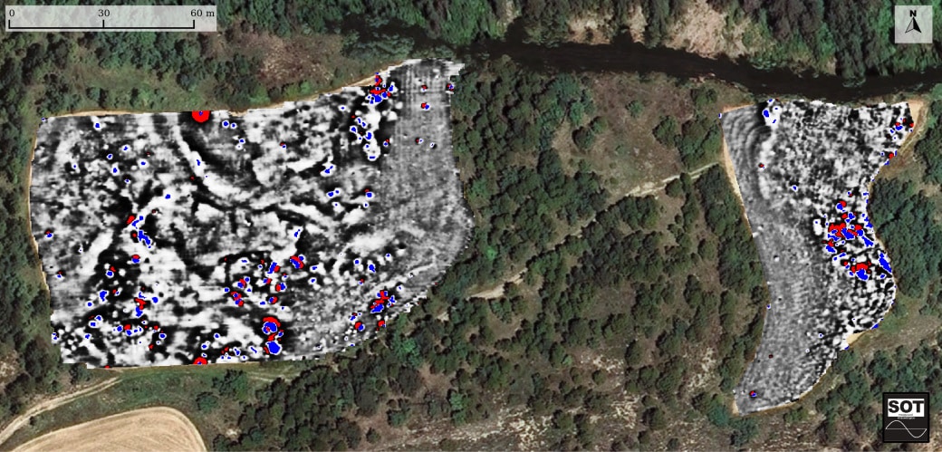
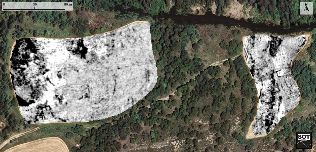
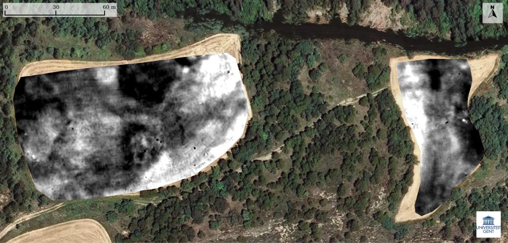
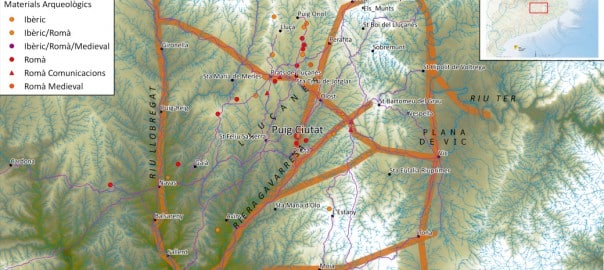
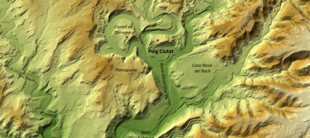
Magnetic surveying showed evidence of an urban layout in the north-east of the site and important signs of combustion, which could have been from fireplaces or they could have been traces of a possible fire.

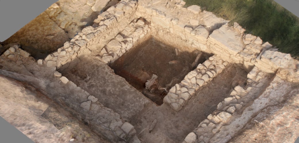
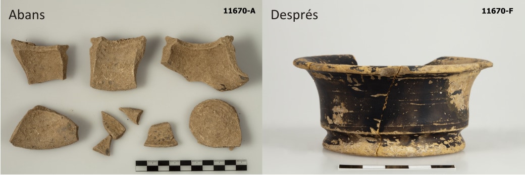
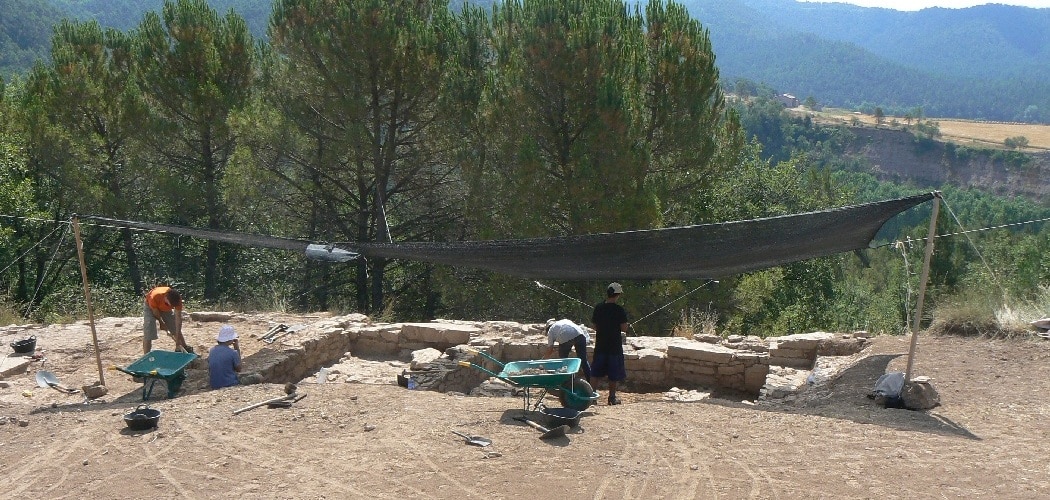
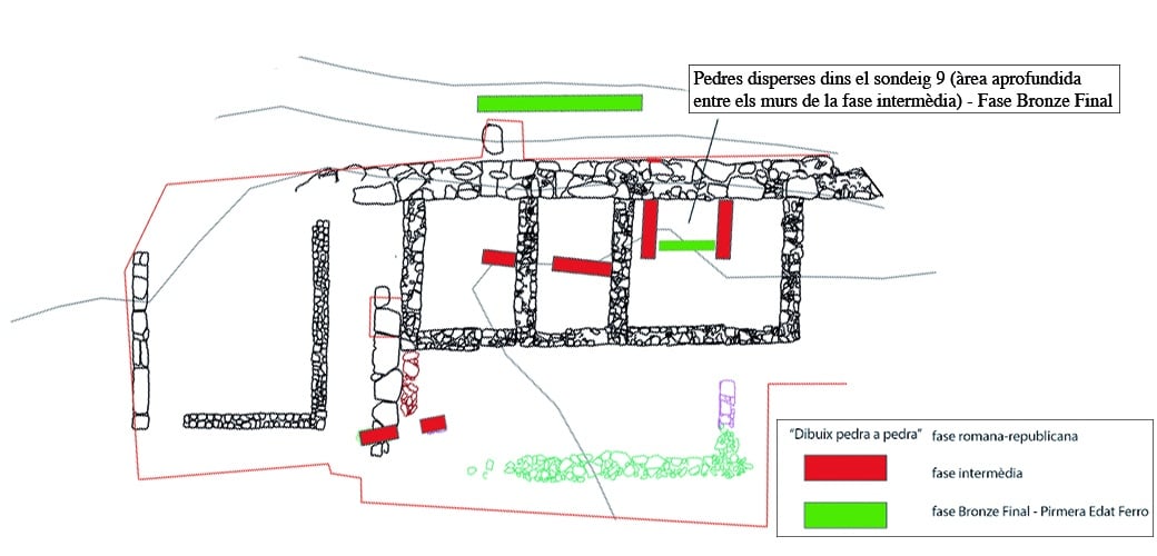
The excavations confirmed the presence of archaeological materials and structures from the settlement’s three occupation phases, going from the Late Bronze/Early Iron Age (mid-9th – 7th centuries BC) to the Late Roman Republican Period (mid-1st century BC).

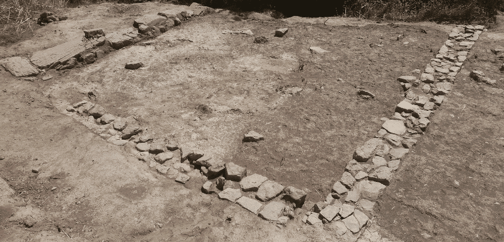
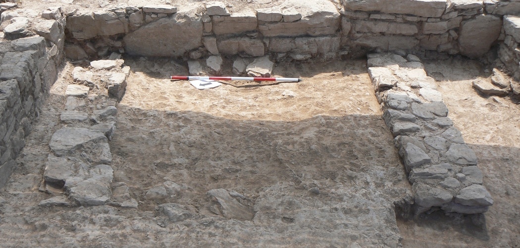
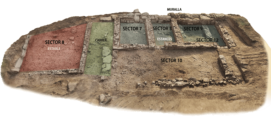
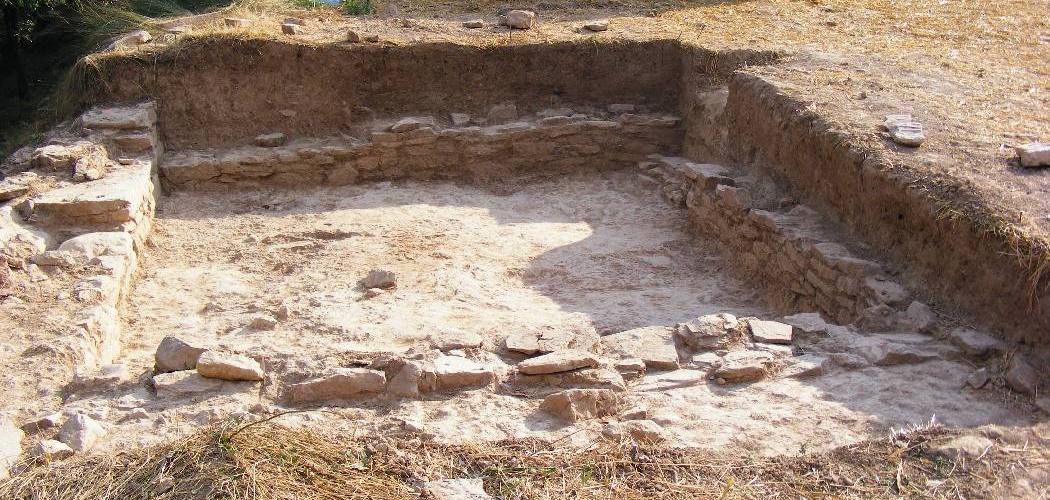
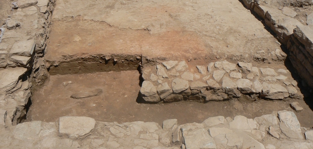
Five dwelling spaces and a street from the last phase were found built onto the north-eastern section of the wall. These constructs could be part of one large building combining the functions of dwelling and storage.

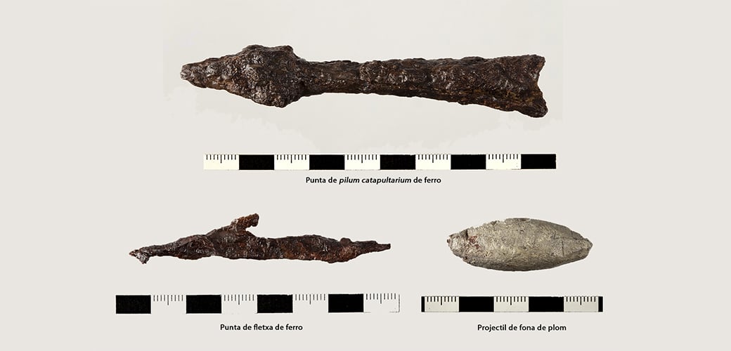
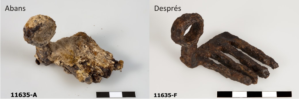
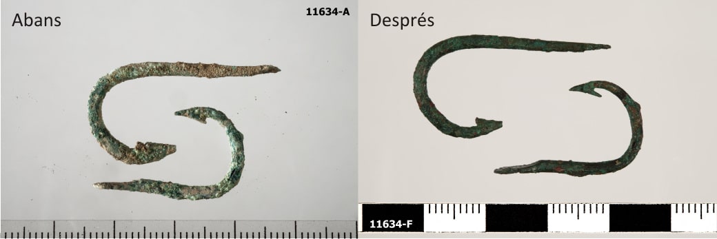
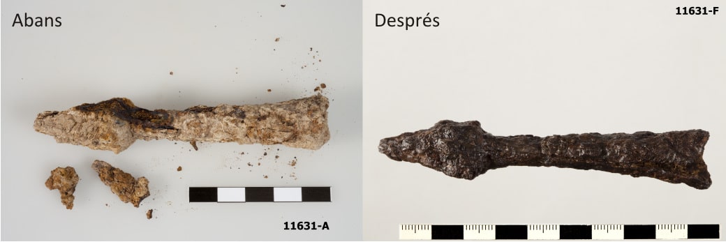
The state of destruction of the different rooms, with abundant crushed ceramic material above the living level, and the presence of abundant military projectiles above the ruins (indicating they were fired from outside) speak for a military confrontation which may have begun at this end of the settlement.
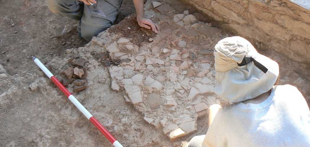
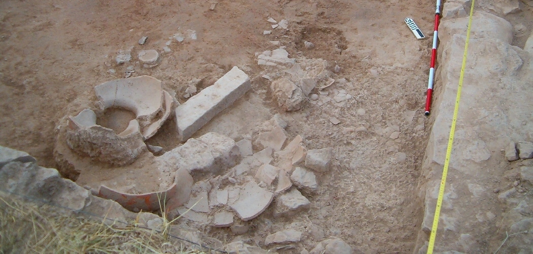
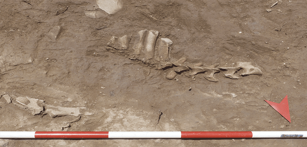
Geophysics

Geophysical methods have made it possible to explore the site in detail and more exactly define the geometry of the structures and their geological surroundings. In this context, geophysical surveying has centred on two fields in the western section and, especially, on the field in the eastern sector, as they allow extensive work that is impossible in the wooded areas.

The main techniques used are magnetic surveying, which provides information on areas with alterations in the electromagnetic field like the ones produced by combustion, ground-penetrating radar, which provides a more precise description of built structures, and electrical surveying, which documents variations in the potentials of sediments.

The results and interpretations obtained with the different techniques are used in the planning and management of subsequent excavations.

Image: © Orthophotograph property of the Institut Cartogràfic i Geològic de Catalunya, accessible on www.icgc.cat.

Geographic Information Systems

In view of the multidisciplinary nature of the Puig Ciutat archaeological project, it was necessary to develop a common platform from which to visualise and interpret the data obtained. In this respect, the platform used was built using the Qgis free software program. Alongside this, the Sig.Arq. program was used to manage the results of the excavations. This program allows you to enter the results of excavations in a spatial data base in a way that is systematic, uniform and georeferenced.

Image: Orthophotograph property of the Institut Cartogràfic i Geològic de Catalunya, accessible on www.icgc.cat.

Photogrammetry

To analyse and document the best-preserved structures in the Puig Ciutat site in detail, several photogrammetric studies have been performed. This technique provides geometric, radiometric and semantic information about three-dimensional objects in reality, using different photographs taken from different points of view. The model generated, despite not having real measurements, does have relative measurements that can be converted to real measurements and even to geolocation points if backup markers on the ground are used. This technique produces a model of reality, first in the form of points and polygons and, subsequently, on a solid, textured surface. In this respect, photogrammetry not only provides volumes and 3D measurements, it also offers quality, accuracy and speed in the execution and obtention of large amounts of information.

Restoration

The process of restoring archaeological movable objects begins the moment they are discovered, as the state in which they are found in the subsoil is altered. The aim of acting on archaeological material is to recover the objects’ lost solidity and stabilise all active factors of alteration.

To a large extent, restoring Puig Ciutat has been the work of Eulàlia Ribó and thanks to the availability of the Centre de Restauració de Béns Mobles de Catalunya (CRBMC, Catalan Restoration Centre for Movable Heritage).

Photographs by Ramon Maroto (CRBMC).

3D scanning

So as to document the most important and best-preserved items in 3D, a low-cost scanning system has been used which is known as the Matter and Form project. With this we can generate a 3-dimensional digital version of the main items in a short time. The main object of this operation is to aid in reporting and disseminating the different materials recovered during the different archaeological campaigns through a Virtual Museum.

The Historical Context

The Civil War between Julius Caesar and followers of Gnaeus Pompeius (BC 49-45)

The excavations carried out so far have given a date for the destruction of Puig Ciutat at the end of the Roman Republic, possibly during the Civil War between followers of Julius Caesar and followers of Gnaeus Pompeius. The map shows the area of influence of the two sides in the moments before the Battle of Ilerda (49 BC), when Caesar had control over Gaul and Pompey over a large part of Hispania. The regions under the control of the Roman Senate also supported Pompey.

Historical sources mention the movement of Caesar’s troops from Marseille to Hispania via unidentified points of the Pyrenees to confront Pompey’s followers, who had taken up position in Ilerda (Lleida).

The Geographical Context

Exploring Lluçanès

Puig Ciutat is located in the area of Lluçanès, a raised plain separating the Ter and Llobregat basins. Although the region has a long history of north-south seasonal herd migration, it’s also clear that there were long-distance routes between the two basins and beyond.

The work of reconnaissance of the terrain and the spatial analysis by the Puig Ciutat team have revealed numerous archaeological sites from ancient times and allowed the start of research on east-west communications in Central Catalonia.

The following image shows a suggested route for the main communications routes crossing Lluçanès in Antiquity and points where archaeological remains have been located. (Source: Cartographic base of the Institut Cartogràfic i Geològic de Catalunya (Cartographic and Geological Institute of Catalonia), accessible on www.icgc.cat).

The Local Context

A Game of Strategy

Puig Ciutat stands in a meander of the Gavarresa stream, which provides a natural defence along part of its perimeter but gives it little long-distance visibility. Occupation of this site, then, probably didn’t respond to the strategic advantages of this meander.

What did the inhabitants of Puig Ciutat defend or control? When was it destroyed? At the end of the Roman Republic? Where was it attacked from? What factions could assailants and besieged have belonged to?

As we’ve seen, some of these questions have now been answered thanks to the work carried out so far.

To solve these mysteries, the Puig Ciutat team is applying traditional archaeological exploration as well as geophysical archaeology or remote sensing over a large area surrounding the site.

Picture: © LIDAR data property of the Institut Cartogràfic i Geològic de Catalunya.